Search Term Record
Metadata
Name |
map |
Related Records
-
-
-
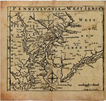
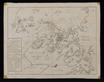
An Historical and Geographic Account...of Pensylvania and of West-New-Jersey in America... HISTORICAL & GEOGRAPHICAL ACCOUNT...PENSILVANIA... - Oxon Arms in Warwick-Lanes, London, England
Thomas, Gabriel
Record Type: Library
-
-
-
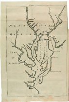
Articles of Agreement between the Colonies of Pennsylvania and Maryland - Maryland / Pennsylvania
Franklin, Benjamin (1706-1790)
Record Type: Library
-
-
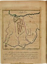
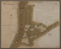
"Carte de l'action de Gloucester entre un party Americain d'environ 350 hommes sous le General LaFayette"
Unknown, Major Capitaine Aide de Camp of Gen. Lafayette
Record Type: Archive
-
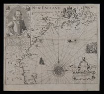
Carte Geographique de la Nouvelle France - Paris, France
Champlain, Samuel (1567-1635)
Record Type: Archive
-
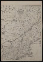
Geographical, Historical, Political, Philosophical, and Mechanical Essays. First, Containing...a General Map of the Middle British Colonies in America... - Pennsylvania, Philadelphia
Evans, Lewis (1700-1756)
Record Type: Library
-
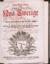
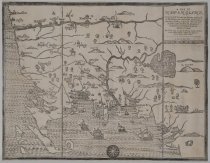
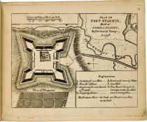
Kort Beskrifning om Provincien Nya Swerige uti America, Som nu fortjden af the Engelske kallas Pensylvania - Sweden, Stockholm
Campanius Holm, Thomas
Record Type: Library
-
-
-
-
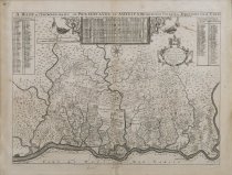
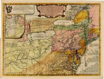
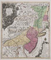
Pensylvania, Nova Jersey et Nova York cum Regionibus ab Fluvium Delaware in America Sitis, Nova Delineatione ob oculos posita per Tob. Cond. Lotter. Aug. Vind. - Augsburg, Germany
Loffer, Tobias Conrad (1717-1777)
Record Type: Archive
-
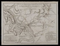
Plan of the Operations of General Washington - London
Faden, William (1749-1836)
Record Type: Archive
-
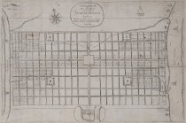
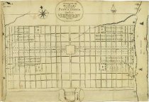
Printed Letter from William Penn with Map of City of Philadelphia - London, England
William Penn (1644-1718)
Record Type: Archive
-
-
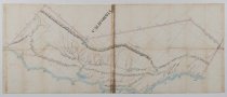
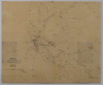
Sketch of the Country and Roads around the City of Mexico
Lee, Robert E. (1807-1870)
Record Type: Archive
-
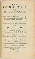
The Journal of Major George Washington...to the Commandant of the French Forces in Ohio... - London, England
Washington, George (1732-1799)
Record Type: Library
-
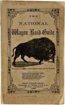
The National Wagon Road Guide, from St. Joseph and Council Bluffs on the Missouri River, Via South Pass of the Rocky Mountains, to California - California, San Francisco, 125 Clay Street, Corner Sandstone
Wadsworth, William
Record Type: Library
-
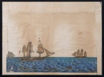
The Whaling Ship 'Roscoe' of New Bedford and Two Other Whaling Ships Engaged in Whaling in the Sandwich Islands - Massachusetts, New Bedford
Nelson, Horatio E.C.
Record Type: Object
-
To the Honourable, The United States of American in Congress convened, The Memorial of Nathaniel Sackett, in behalf of himself and his Associates...." - New York
Sackett, Nathaniel (1737-1805)
Record Type: Library