Archive Record
Images
Additional Images [2]
Metadata
Title |
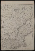
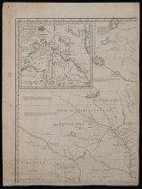
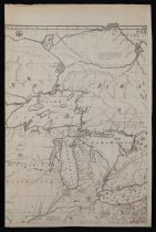
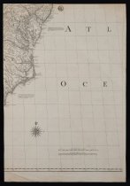
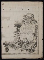
A Map of the British and French Dominions in North America |
Creator |
Mitchell, John |
Date |
1755 |
Dimensions and Materials |
Laid Paper Eight Sheets Each: H: 27" W: 19" Scale: 69 miles to 1 degree 32 miles to 1 inch |
Scope & Content |
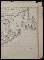
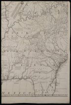
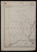
This map, showing the known geography of North America at the time of the French and Indian War, is the most comprehensive pictorial record of this region made during the Colonial Era. As such, it was the cartographic document that representatives of Great Britain and the United States consulted in Paris in 1782 and 1783 as they negotiated the treaty that terminated the Revolutionary War and recognized the independence of the United States. The Foundation holds a first edition, third impression of the map, which was drawn by John Mitchell (1711-1768) and features a highly pictoral title cartouche inscribed: "A Map of the British and French Dominions in North America with the Roads, Distances, Limits, and Extent of the Settlements, Humbly Inscribed to the Right Honourable The Earl of Halifax, And the other Right Honorable The Lords Commissioners for Trade & Plantations, By their Lordships Most Obliged and very humble servant Jn Mitchell." "Depot GL. de la Guerre" is printed on each of the eight sheets of the map, which all together measures four feet, six inches by six feet, five inches. John Mitchell was born in Lancaster County, Virginia and studied medicine at the University of Edingurgh before returning to his birthplace to become a doctor and also a botanist. In 1746, ill health forced Mitchell to leave Virginia for London, where he served as a consultant and spent most of his time researching and creating this map. |
Provenance |
Prince Eugene de Beauharnais (1781-1824) Library of Congress, United States W. Graham Arader III, King of Prussia, Pennsylvania Sold to The Dietrich American Foundation, 1977 |
Object Name |
Map |
Object ID |
101.311 |
Search Terms |
map maps |